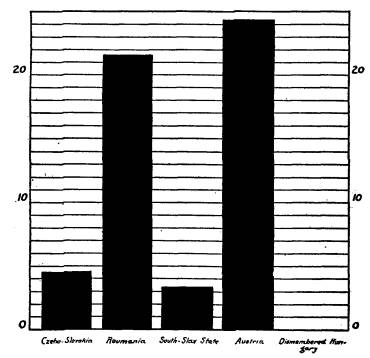
Table salt
production in countries neighboring Hungary. Not a pinch of table salt was left
for Hungary. -- Redrawn from Dr. L. Buday's "Dismembered Hungary."
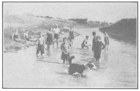
This is the small brook, "Ronyva," in Upper-Hungary, which the Czech leaders represented to the Paris Peace Conference to be a "navigable river" and on that representation it was given to Czechoslovakia. Note the depth of the "navigable river." The dog is shown standing in the middle of the "river," its head pointing toward Hungary and its tail wagging toward Czechoslovakia. The children, knee deep in the water, are wondering what kind of "boat" the Czech leaders intended to float on this "river."
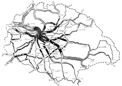
Budapest,
Capital of Hungary, is the natural center of every means of transportation not
only of Hungary but also of Middle Europe.
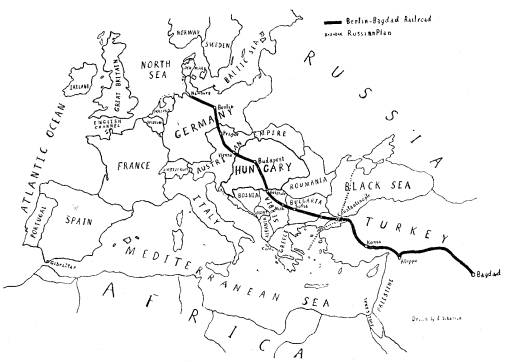
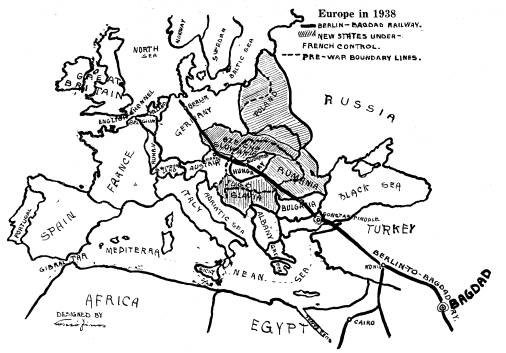
Pre-war Europe,
the pre-war territory of Hungary, and the Berlin-Bagdad Railroad. Dotted line from
the Black Sea to the Mediterranean Sea indicates the intersection of Russian
plan and the Berlin-Bagdad Railroad. It was around this point that the World
War was fought and not "to make the world safe for democracy."
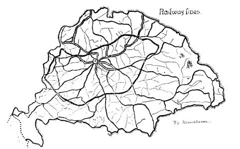
Railway
lines in pre-war Hungary
The railway
lines in pre-war Hungary reached into every part of the country and greatly
facilitated travel and commerce.
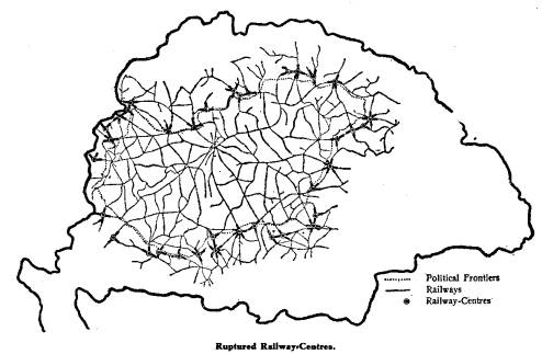
Treaty
of Trianon ruptured and mutilated railway lines of Hungary.
The
railway lines of Hungary ruptured and mutilated by the Treaty of Trianon.
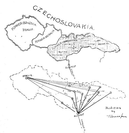
Every point in
the former Hungarian territory, given to Czechoslovakia, is closer to Budapest,
Capital of Hungary, than to Prague, Capital of Czechoslovakia. The shaded area indicates
the territory taken from Hungary and given to Czechoslovakia by the Treaty of
Trianon.
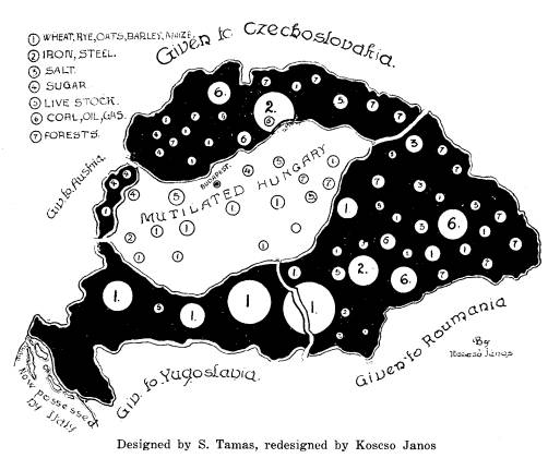
This is the way
Hungary was mutilated by the Treaty of Trianon. The black area indicates the
territories taken from Hungary and the white area, in the center, indicates
what was left. In the Treaty of Trianon 24,000 square miles of land and
3,575,685 people were given to Czechoslovakia, 1,500 square miles of land and
393,000 people to Austria, 24,000 square miles of land and 4,138,000 people to
Yugoslavia, 40,000 square miles of land and 5,265,000 people to Roumania, 21
square kilometers and 49,000 people to Italy. In all 68% of her territory and
59% of her population were taken from Hungary and given to her neighbors. This
international robbery has no precedent in the history of Christian
civilization.
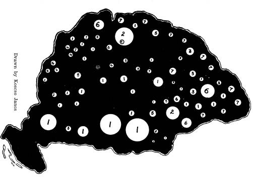
The natural
distribution of the economic resources of pre-war Hungary. The white circles
indicate the nature of the resources.
1. Wheat, rye,
oats, barley, corn. 5.
Livestock.
2. Iron, steel. 6.
Coal, oil, gas.
3. Table salt. 7.
Forests.
4. Sugar.